

Why more Dartmoor walkers are turning to apps to track their tors
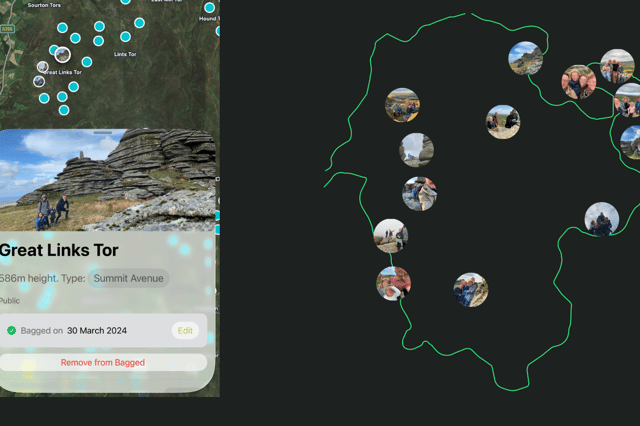

Tor bagging has become an increasingly popular way to explore Dartmoor, with walkers using digital tools to log visits, discover new routes and monitor their progress
A growing number of Dartmoor walkers are turning to digital tools to keep track of the tors they have visited, reflecting a wider interest in "tor bagging" across the national park.
Tor bagging involves visiting and recording Dartmoor's many granite tors, with walkers often working through lists compiled in guidebooks, maps and online resources.
In recent years, several Dartmoor-focused apps and websites have emerged to help people log their progress.
Among them is DartmoorTors, an app created by Dartington-based developer Michael Campbell.
Mr Campbell said the idea grew out of his own family's regular visits to the moor.
"I was inspired to create the app because my family and I make regular outings to the moor, choosing different parts to go to each time," he said.
"We use tors as our to-do list, and to force us to explore new places."
He said the family often struggled to remember which tors they had already visited and sometimes found it difficult to identify distant tors while out walking.
"We were frequently trying to remember which tors we've done, or when out in the field trying to identify distant tors," he said.
Mr Campbell initially developed the app for personal use before deciding to make it available to others after discovering friends faced similar challenges.
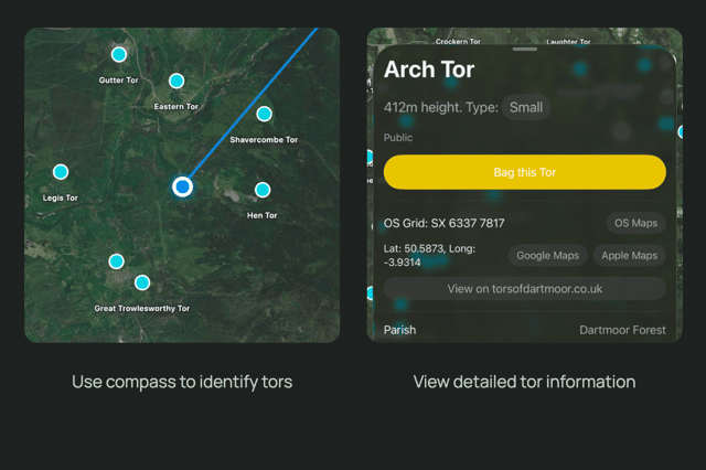
Before creating DartmoorTors, he researched existing options but wanted something focused specifically on Dartmoor.
"I wanted something that was Dartmoor-specific, felt like other apps on my phone in terms of ease of use, but was lightweight and modest in its ambitions," he said.
The app allows users to work through different collections of tors, record completed visits and add photographs.
It also includes a compass feature designed to help identify landmarks visible from the moor.
Mr Campbell worked with the team behind TorsOfDartmoor.co.uk to incorporate a database of more than 900 tors and significant rock features.
He also sought permission from authors and contributors whose tor collections are included within the app.
Interest in tor bagging has been growing for several years, helped by social media, walking communities and a wider appreciation of outdoor activities.
Mr Campbell believes the trend reflects people's desire to explore the landscapes around them.
"I suspect the growing interest in tor bagging comes from the same place where we started," he said. "We are invested in where we live and we love the natural assets that surround us."
He added that the Covid-19 pandemic may also have encouraged more people to spend time outdoors.
The app remains in its early stages, with around 20 downloads on iOS and about 15 Android beta testers currently trying the platform ahead of a wider release.
Mr Campbell said feedback from users had been positive, with one of the most commonly requested additions being Ordnance Survey mapping.
Alongside DartmoorTors, other Dartmoor-specific tracking tools have appeared in recent years.
Earlier this year, The Moorlander reported on Exeter-based web designer Eder Da Silva who launched TorBagger, a web-based platform allowing users to record which tors they have visited and track their progress across Dartmoor.
The Moorlander contacted Eder for a follow-up on TorBagger, but did not receive a response by the time of publication.