

Moor Outdoors


Cox Tor, Peter Tavy Combe & Stephen’s Grave – 6 miles
(An OS Map of Dartmoor is essential to be able to follow this walk )
Carry on northwards along the top and descend as far as a track that runs across the hillside towards the lane below and then crosses it. Turn left along it. This is the old quarrymen’s path that the villagers of Peter Tavy took to their workplace at Merrivale Quarry. They often had to walk it in very misty conditions, so where it crosses the open moorland it was built in places into a kind of causeway to guide them on their way. Follow this track through old field enclosures, forking right where the path splits, as far as scenic Great Combe Tor with its lovely views of Peter Tavy and the surrounding lowlands. At this point you need to head steeply downhill to the stream (Colly Brook) and pick up a path that runs alongside it. It’s a delightful stream with little waterfalls and dells and moss-covered woodlands cloaking the hillsides. The final stretch of this path takes you past the remains of a swimming pool fed by a leat. There’s a bench and it’s a peaceful spot to have a break. When you reach the fern-covered bridge, cross it and take the path to the right which climbs back out of the valley through mixed woodland. When you hit another tiny lane, turn left for a short distance and then pick up the footpath heading eastwards over Smeardon Down towards the open moor. You’re now on an old peatcutters’ track – the Peter Tavy villagers walked this way to Langstone Moor where a good thick layer of peat for their fires could be harvested.
This path has fabulous views over Cox, Roos and Staple Tors on the other side of the valley. Ahead you can see the flagpole at White Tor which marks the start of the military firing zone – but you’re not going that far. When you reach the small stone that marks Stephen’s Grave, you turn right downhill. This is the grave of a young man who poisoned himself because he could not marry the woman he loved (it’s not known whether she spurned him or the families wouldn’t permit it). Suicides were not buried in graveyards in those days, but instead were interred at crossroads in the hope that when their restless spirits returned, determined to seek out those who had caused them such misery, they would not know which of the four possible routes to go down. The female, more famous equivalent is Kitty Jay’s Grave near Hound Tor. This one is a simple stone with an S on it, but what a glorious location!
Follow the path downhill until it meets a reave (low prehistoric boundary wall) which you should follow to your left to walk through a rather marvellous Bronze Age village complete with outer walls and a lot of hut circles. Walk down to the stream from here (lovely spot for a picnic), follow it downstream, cross by the farm wall and follow the path back up out of the valley. On your left you will see another very large prehistoric settlement with many hut circles dotted about the valley floor. It’s hard to imagine now, but four thousand years ago this would have been a busy part of the moor!
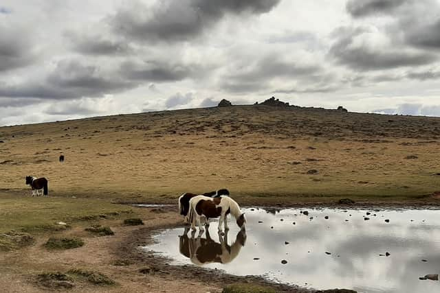
Keep walking uphill and you reach the col between Roos Tor and Cox Tor with a delightful little pond nestled in it. There are yet more panoramic views, this time south and eastwards and you’ll be able to see the car park you started from below.