

Sharrah Pool circular

Car park: New Bridge, grid reference: SX 711 708. Dartmoor Explorer map OL28 The whole circular walk is approximately 5.6 miles/9km. There and back to Sharrah Pool is approximately 4.5 miles/ 6.8 km. The walk along the River Dart is undulating with so
Car park: New Bridge, grid reference: SX 711 708.
Dartmoor Explorer map OL28
The whole circular walk is approximately 5.6 miles/9km.
There and back to Sharrah Pool is approximately 4.5 miles/ 6.8 km.
The walk along the River Dart is undulating with some rocky parts. The ascent to the ridge is steep. The return towards Holne is along the road followed by a footpath returning to the river.
This is a lovely walk to do on a hot day as the walk up the Dart to Sharrah Pool is wooded. However, on a hot day the car park at Newbridge can be very busy because of the popularity of swimming at Deeper Marsh on Spitchwick common, just downstream.
Newbridge car park has toilets but no rubbish bins so please take your rubbish home. Cold water swimming can be hazardous, so come prepared with warm layers and a hot drink. If doing the circular route, the ascent from the Dart to the ridge is steep so some may find walking poles a benefit. This part of the walk is challenging but the views from the top reward the effort. From Newbridge it takes about an hour to walk upstream to Sharrah Pool.
From the car park, cross the bridge which dates back to mediaeval times. Now take the footpath to the right and where the path divides, take the lower path; there are some pools here where you can have a dip. This path is generally surfaced with small stones but it can get quite muddy where small water courses cross it. There is a large pool for a dip before a steep climb and about 15 minutes from the start. About 30 minutes into the walk there is a small open glade bounded by old walls where you will find bluebells in the appropriate season.
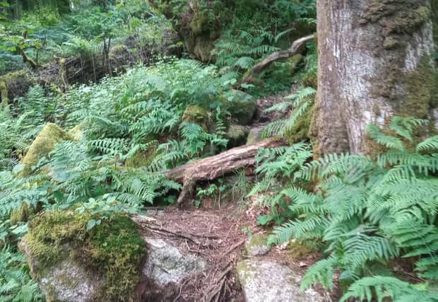
After this, the path can become a bit awkward with some subsidence, some wet areas and fallen trees to clamber over. When you come to a small waterfall to cross, you’re nearing your destination. Eventually, you will come to a stile and there is a bouldery descent to the pool, which you can see below. The path ends at the pool so you will know you’re there!
En route you may see wood mellick, mosses and ferns, whortleberries and wood sorrel.
To continue the whole circuit, return to the stile and turn steeply uphill on a vague path through boulders and keeping the wall and fence on your left. After 10 minutes of steep climbing you will emerge on to open heathland with bracken and foxgloves. Follow the wall as it bends left and then follow the wall to the right. At the wall corner follow it round to the left. Look out for sausage moss on the trees here.
Unless you want to go ahead to some rocks for a picturesque lunch spot, follow the wall keeping it on your left until you come to the road. You will cross an old leat several times. From up here you will have lovely views across the Dart valley to Mel Tor and Dr Blackall’s Drive and also south-west to Ryder’s Hill and Snowdon beyond Venford reservoir, which is surrounded by trees.
Walk along the road for about a mile, staying to the left fork before taking a left-handed footpath on the left at Butts. If, however, you are in need of some refreshment, you could peel off this route and by heading right just beyond this footpath entrance, you could go into Holne village where you will find a pub and community shop/tea room.
By returning to the footpath at Butts, you now need to follow this path downhill through several fields and into the woods; this being a part of the Two Moors Way and the High Moors Way. This path will lead you back on to your original path by the river and back over Newbridge to the car park.