

From sea fog to scorching: Devon emerges from its grey cocoon as UK heatwave looms
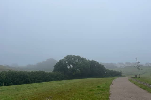

Three days of eerie sea fog have left Devon shivering on the edge of summer. This weekend, it could be swapping that grey blanket for the hottest June temperatures since 1957
It has felt, in recent days, more like November than June. Across Devon, a stubborn blanket of low cloud and sea fog has smothered the coastline and crept inland, blotting out the sun, and prompting more than a few residents to reach for a jumper, or even contemplate lighting the fire.
With the summer solstice only days away, the official start of summer falling on 21 June, the contrast has been striking. Instead of long, balmy evenings and ice creams on the seafront at Plymouth or on the moors, Devon has been draped in an almost spectral murk, visibility reduced to a few dozen metres in places.
Why the fog?
The Met Office says the prolonged murk is down to a combination of very light winds and a stable atmosphere, conditions that allow low cloud and coastal fog to form readily but prevent it from lifting.
"The recent persistent low cloud and fog in Devon is due mainly to the fact that light winds and a stable atmosphere means these are slow to clear, particularly along coasts."
Coastal counties such as Devon are particularly susceptible to this kind of foggy interlude in early summer, when sea temperatures are still relatively cool, but the land has begun to warm. The resulting mist can linger stubbornly for days, locked in place until a change in the wider weather pattern forces it to disperse.
The dramatic change ahead
That change, forecasters say, is now arriving, and when it does, it will be dramatic. High pressure building to the south of the UK is set to drag a plume of warm, humid continental air northwards, replacing the cool murk with something far more summery.
Met Office Chief Forecaster Steve Ramsdale said: "From the end of the week, a marked north–south split develops. High pressure over mainland Europe will allow increasingly warm and humid air to build across southern and eastern areas, while lower pressure close to the northwest keeps conditions more changeable."
Across the UK, the picture is one of two halves. The north and west will see spells of rain, some heavy, and temperatures closer to the seasonal average. But for southern and eastern England, a burst of genuine and potentially historic heat is on the way.
Could a record fall?
Deputy Chief Forecaster Gregory Wolverson said temperatures in the south and southeast could reach 32°C on Sunday, rising to a possible 34°C or higher on Monday, and that is not the most striking part of the forecast.
"There is currently a 40% chance of exceeding the current UK June maximum temperature record of 35.6°C, set in 1957 and 1976," Mr Wolverson said. "There is also a lower chance of exceeding the June maximum temperature record for Wales."
He added a note of caution, however: "It's important to note that while temperatures may be high, we might not all see the wall-to-wall sunshine and blue skies we experienced back in late May because there may be more cloud around. Couple this with fairly high humidity, and it may feel rather oppressive at times. There is also a chance of thunderstorms developing in places, which could bring heavy downpours and localised impacts."
Much of central and western Europe is also experiencing notable heat, with temperatures well above average in places, helping to feed warmer air towards the UK as the weekend approaches.
Forecast snapshot: headline temperatures
Friday 20 June - 32°C in East Anglia Saturday 21 June - 28°C as the warmest air temporarily shifts away Sunday 22 June - 32°C in south and southeast England; heatwave criteria likely met Monday 23 June - 34°C or higher possible in south and southeast England; 40 per cent chance of breaking the UK June record
Health warnings upgraded
The UK Health Security Agency (UKHSA) has upgraded its alert for a swathe of southern and eastern England to an Amber Heat-Health Alert — a step up from the Yellow alert issued earlier in the week. A Yellow alert remains in place for the Midlands. All alerts run until 8pm on 23 June.
The amber alert signals a significant risk to health, particularly for vulnerable people, including the elderly, the very young and those with underlying conditions.
Devon's turn - but watch the water
For Devon, the transition may feel particularly abrupt. Within the space of a week, residents could go from peering into opaque walls of fog to sweltering in temperatures approaching 30°C — a swing that underscores just how variable the British summer can be.
But those heading to the coast are being urged to take care. Despite the heat, sea temperatures around Devon remain well below mid-summer levels, and the RNLI is warning of the dangers of cold water shock.
Samantha Hughes, National Water Safety Partner at the RNLI, said: "With warmer weather approaching, it's important to remember that the water is still cold. Entering it unexpectedly can lead to cold water shock, causing a sudden increase in breathing and heart rate, which may trigger panic.
"If you find yourself struggling in the water, remember to Float to Live: tilt your head back so your ears are submerged, relax and control your breathing."
Where possible, the RNLI advises choosing a lifeguarded beach and swimming between the red and yellow flags. In a coastal emergency, call 999 for the coastguard.
Met Office updates are published at metoffice.gov.uk. The UKHSA Heat-Health Alert dashboard can be found at ukhsa-dashboard.data.gov.uk.