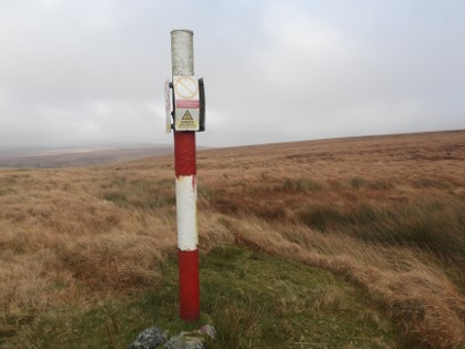
It was announced that Dartmoor Training Area range danger area boundary was moved to give the public all year round access to various tors. (Credit Dartmoor Explorations)
In a significant move to enhance public access to the stunning landscapes of Dartmoor, The Devon and Cornwall Training Areas announced on January 29, 1996, that the Dartmoor Training Area range danger area boundary was relocated. This alteration granted the public year-round access to iconic landmarks including Great Mis Tor, White Tor, Roos Tor, and Watern Tor.
The decision to shift the danger area boundary was made after a month-long public consultation, concluding before Christmas of 1995. According to reports from that time, "No significant comments were received" during the consultation period. The Secretary of State for Defence subsequently issued new bylaws amending the boundary, allowing locals and visitors unrestricted access to these natural wonders.
The change in boundaries aimed to strike a balance between military training needs and preserving the beauty of Dartmoor for public enjoyment. The move received approval from the authorities, and the implementation marked a milestone in the ongoing relationship between the military and the community.
Accompanying this announcement was a picture featured in a pamphlet issued by the Ministry of Defence (MOD) for walkers. The image depicted the parts affected by the boundary change, overlaid with yellow dotted lines, based on the latest Ordnance Survey (OS) Map atop a 1983 Dartmoor National Park map. The older map, described as a "guide for walkers," showcased the region's military ranges.

The picture displayed the "fat" range pole, colloquially known as "The Totem Pole," where the three ranges of Okehampton, Willsworthy, and Merrivale intersected. This symbolic pole represented a point of convergence and unity among the various military training areas.
The decision to open up these scenic locations, coupled with the lack of notable objections during the public consultation, reflected a harmonious collaboration between the military and the public, facilitating broader access to Dartmoor's natural treasures. The yellow dotted lines on the map illustrated a positive shift, allowing enthusiasts and nature lovers to explore the beauty of Dartmoor more freely.
As of the announcement date, January 29, 1996, the amended boundaries signified a commitment to coexistence between the military training needs and the preservation of Dartmoor's unique landscape for generations to come.
Subscribe or register today to discover more from DonegalLive.ie
Buy the e-paper of the Donegal Democrat, Donegal People's Press, Donegal Post and Inish Times here for instant access to Donegal's premier news titles.
Keep up with the latest news from Donegal with our daily newsletter featuring the most important stories of the day delivered to your inbox every evening at 5pm.