
Hennock school table tennis opening
Search
07 Mar 2026
Please allow ads as they help fund our trusted local news content.
Kindly add us to your ad blocker whitelist.
If you want further access to Ireland's best local journalism, consider contributing and/or subscribing to our free daily Newsletter .
Support our mission and join our community now.
To continue reading this article, you can subscribe for as little as €0.50 per week which will also give you access to all of our premium content and archived articles!
Alternatively, you can pay €0.50 per article, capped at €1 per day.
Thank you for supporting Ireland's best local journalism!

An area in Little Bovey between two bridges is a known flood plain Credit- Google Maps

Concerns around flooding at Little Bovey have been raised again after councillors heard that the area continues to face regular and worsening problems during the winter months.
The issue was discussed at a recent Town Council meeting, with further details shared to The Moorlander in an interview with County Councillor Sally Morgan this afternoon (17 November).
Cllr Morgan told The Moorlander the flooding problem is “not new” and has been “going on for a very, very long time”, but warned that climate change is now making the situation harder to manage.
READ NEXT: Tavistock drivers warned of major A390 and A386 roadworks starting early in the New Year
She said recent winters have brought more severe and longer-lasting conditions, adding that “last winter went on longer than before, it lasted weeks, and therefore people were cut off for weeks.”
The area is classed as Flood Zone 3, meaning it has a high risk of flooding, and according to Cllr Morgan, this level of risk would likely prevent planning permission for new development on the site today.
She said the situation is particularly difficult because Little Bovey sits on a natural flood plain and is also affected by tidal conditions, which can push water back upstream.
Although nearby homes are currently safe, the road through Little Bovey floods every winter.
Cllr Morgan said this affects day-to-day life for local families: “People can’t get through to get to the school bus,” she explained. “It’s extremely difficult to manage.”
The Town Council heard that the Environment Agency has visited the site, but major engineering work is unlikely: “They came out, but there’s not a huge deal we can do,” Cllr Morgan said.
However, some work downstream may help ease water flow, and landowners are involved in discussions. “We can clear further downstream with input from landowners,” she said.
Cllr Morgan said she had met with a highways engineer this morning (17 November) and confirmed that new height-gauge signs will be installed “as soon as possible before winter sets in” to warn drivers of flood depth.
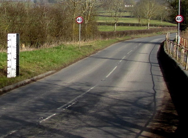
ABOVE: Roadside flood gauges, like this one in Herefordshire, are looking to be introduced (Credit: Jaggery)
She said the aim is to stop people “being tempted to take risks.”
Flood-prevention work is also taking place on Dartmoor through the Headwaters Project, which focuses on slowing water at its source, particularly during heavy rainfall.
“Climate change has worsened incidents with large amounts of rain,” she said.
Despite ongoing efforts, Cllr Morgan was clear that no long-term fix is likely. “We can’t stop the floods,” she said. “What we can do is help the water flow more easily and put in safety measures.”
She added that residents know the area well and understand when conditions are dangerous, but the Council hopes improved signage will support people travelling through the area, especially visitors and school traffic.
The council expects to continue discussions with the Environment Agency and highways teams as winter approaches.

Subscribe or register today to discover more from DonegalLive.ie
Buy the e-paper of the Donegal Democrat, Donegal People's Press, Donegal Post and Inish Times here for instant access to Donegal's premier news titles.
Keep up with the latest news from Donegal with our daily newsletter featuring the most important stories of the day delivered to your inbox every evening at 5pm.


")
")

